The narrow Shelburne Valley, defined by the Androscoggin River and mountain ranges to the north and south, has a long history of hikers enjoying its mountain trails. Settled late in American history, the first white settlers did not venture into the half-mile wide valley until just before the Revolutionary War. The river bottoms, at an elevation of 700 feet, provided fertile farmland to the settlers, but the two defining mountain ranges rising to elevations of 3,000 feet to the north and 4,000 feet to the south curtailed further development in town.
While the low valley has been lightly developed, with an average population of less than 400 residents over the past two and one-half centuries, the mountains remained essentially unchanged except for periodic timber harvests. Shelburne remained a small farming village for most of its first 100 years, and then in the mid-1800’s a number of large estates were created by wealthy Boston and New York residents for their summer use. Those estates and their grand homes have largely disappeared, with only remnants of the Whitney Farm still remaining from that era.
The forests of Shelburne have always been a resource to its residents, first logged by the local farmers and then by the large timber barons at the beginning of the 20th Century. Recreational hiking did not come into existence until the 1860s when several local farms and cottages began to take in summer guests from Boston and points south. The Philbrook Farm Inn began hosting hikers at that time and continues to offer rooms and cottages to guests and is still owned by the Philbrook family descendants.
Many of Shelburne’s mountains, ponds, and other features were named by Lucia Pychowska and her daughter Marian during their extensive explorations of the Mahoosuc Mountains between 1872 and 1877. Their report printed in Volume II of AMC’s Appalachia journal (1879-1881) extensively details their explorations and documents the first recreational hiking trail leading to Bald Cap Peak and Dream Lake, which was cut in 1877 by AMC founder R. Stuart Chase. Major trail building continued through the 1930s and today’s extensive trail system remains as a legacy of those years.
The Appalachian Mountain Club’s (AMC) White Mountain Guide documented Shelburne’s hiking trails from its earliest editions and a review of those guides reveal trails being abandoned or re-routed as logging or other environmental factors impacted the trails. The Randolph Mountain Club (RMC) maintained many of the Shelburne hiking trails during the mid 20th Century and other trails were maintained by the town as fire trails with many following logging or old woods roads. One of the earliest hiking maps produced locally was printed by the Philbrook Farm Inn for its guests in 1958 by Thorn Dickinson and documented the extensive network of trails surrounding the inn. The Shelburne Conservation Commission offered a comprehensive hand-drawn trails map for all of Shelburne in 1981 that included hiking and fire trails into Success Township. The RMC eventually stopped maintaining trails in Shelburne’s Mahoosuc Mountains and some of the more local trails began to be dropped from successive AMC White Mountain Guides due to lack of maintaining organizations and the abandonment of trails or discontinued maintenance of the old fire trails.
Several Shelburne residents began to recognize the loss of the town’s long heritage of hiking trails and in 2010 formed the Shelburne Trails Club to restore “lost trails” that were abandoned and dropped from earlier trail maps and guides and to maintain those trails and assume maintenance of the Philbrook Farm trail system. The extensive Philbrook trail system had been maintained by guests from the Briggs family since the mid 19th Century, but with the prime maintainer now in his 90s, a new trail maintainance option was needed.
The Shelburne Trails Club published its own large scale Tyvek trails map in 2016 that included the Shelburne trails restored by the club and all of Shelburne’s network of more than 40 miles of hiking trails in both the Carter-Moriah Mountain Range and the Mahoosuc Mountain Range extending into Success Township. The AMC also began to again reference Shelburne’s “lost trails” in its White Mountain Guides at the same time. This extensive network of hiking trails in Shelburne’s two mountain ranges are now maintained cooperatively by volunteers from the Shelburne Trails Club (STC), the Appalachian Mountain Club (AMC), and the US Forest Service (USFS).
The large network of inter-connected hiking trails in Shelburne offers a wide range of hiking opportunities and multiple route planning options. Plan a short hike for half a day, a day’s outing, or and overnight backpack — they are all options. Wide open vistas are available from both high mountains and lower summits and waterfalls and high elevation ponds can be reached with a little effort.
[metaslider id=8903]
Follow the White Blaze: The Appalachian Trail makes up part of the town’s network of trails and enters Shelburne from the South near Mt Moriah, descends the Rattle River Trail to US Route 2, crosses the Androscoggin River over Leadmine Bridge, then climbs from Leadmine State Forest to the summit of Mt Hayes and on to Dream Lake, continuing northeast through Success Township and on to Maine and Mt Katahdin. The twelve miles of the AT in Shelburne are maintained by the USFS in the Carter-Moriah Range and by the AMC in the Mahoosuc Mountain Range.
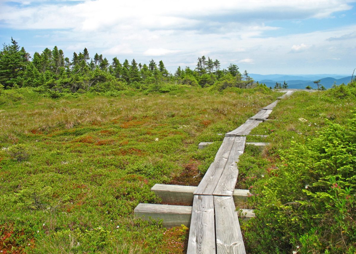
Follow the Blue Blaze: The AMC maintains the blue blazed Peabody Brook Trail and Austin Brook Trail that connects to the Appalachian Trail from North Road. Those trails lead to Dream Lake and Gentian Pond respectively and the open lean-to shelter at Gentian Pond is one of the most popular overnight hikes. The Peabody Brook Trail passes by the impressive Giant Falls and was part of the AT until a re-route and creation of the Centennial Trail in 1976. The USFS also maintains the blue blazed Kenduskeag Trail connecting the AT to the Shelburne Trail along the boundary of the Wild River Wilderness in the Carter Moriah Range. The portion of that trail between the AT and Shelburne Moriah Mountain includes an extensive section of bog bridges with impressive open views.
Follow the Yellow and Orange Blazes: The USFS maintains the yellow blazed Shelburne Trail from the Wild River Wilderness to US Route 2 near the Maine border. STC maintains a network of yellow and orange blazed inter-connecting trails in the Mahoosuc Range that are divided by the Austin Mill Brook which can be crossed by STC’s unique cable car crossing. Those trails also lead to the summits of Mt. Crag, Middle Mountain, Mt Ingalls, and Bald Cap Ledges with excellent views of the Androscoggin River Valley. Mt Crag is a particularly favorite family hike.
Follow the Rainbow Blazes: STC now maintains the extensive trail system surrounding the Philbrook Farm Inn with its Red, White, Blue, Orange, and Yellow blazes. The Philbrook Farm trail system predates the AMC and ATC protocol for blazing the AT in white, AT connecting trails in blue, and all other trails in yellow blazes. The inn continues its unique and historic blazing system. The Philbrook’s white blaze trail does not follow the AT, but climbs to the two summits of Crow Mountain near the Maine border. Both the red and blue blazed trails climb to the summit of Mt Cabot, which is on Philbrook property and offers a loop hike to the summit. A connector trail from the Red Trail to the Scudder Trail also offers a climb to Mt Ingalls or a descent back to the inn via the Yellow Trail.
Many of the town’s hiking trails pass through public lands, but a significant number of trails in the Mahoosuc Range pass through multiple privately owned tracts of forestland. We ask all trail users to use Leave No Trace practices and act in a manner that respects those private landowners.
The Shelburne Trails Club is supported entirely by volunteers and has no paid staff. The town and its residents actively support the club and the town hosts club events at the Shelburne Town Hall and prints the STC Annual Report in its own Town Report each year. Our trails club has revitalized local interest in our trails and the trails are now widely recognized as a vital local asset.
The Shelburne Trails Map is available at local merchants in Gorham and elsewhere and can also be purchased at town hall or directly through the club. For more information about the club, please visit us at www.Facebook.com/ShelburneTrailsClub.